How to Get Map Area & Distance Measure Online with Geo Measure Area Calculator?
Have you ever thought or imagined how we can find Area and Distance on a MAP?
Right??
First, we all have to be aware of the term GPS Navigation…
What is GPS Navigation?
GPS stands for Global Positioning System. GPS is a 24 satellite navigation system that uses multiple satellites and signals that can find the position of the receiver on the earth. GPS is developed by the U.S. DoD (Department of Defense). These technologies are used for military purposes. Since 1980. When these GPS systems are available for consumers they become shown commonly in cars, boats, cell phones, mobile devices, and even in personal Head-up-display glasses.
GPS systems are working in almost every condition and they are accurate to within 3-15 meters, which depends on the number of signals that are received, the spread of the satellites in the sky, and the technologies that are used in the receiver.
What GPS can Calculate?
- Location – determining a position
- Navigation – location from one to another
- Tracking – monitoring object or personal movement
- Mapping – creating maps of the world
- Timing – world precisie timing
What is GPS used for today?
From mining to aviation, agriculture to marine, recreation to defense, there are so many applications available in the market that are working in this technology. These are the days that everyone: doctors, scientists, farmers, drivers, and many other people are using GPS systems to make themselves more productive.
There are the three main industrial uses of the GPS (Global positioning system) that includes agriculture, automotive, and defense. In this, every field GPS can solve a positioning problem. Episodes of the seven GNSS series can give an explanation of how satellite positioning supports these unique applications.
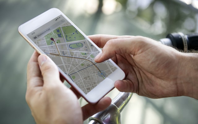
How to Measure Distance on a Map?
This land surveying app is useful for so many users. There are so many apps available in the market that give you a measurement but we found the best one for you named Geo Measure Area Calculator called Geomeasure which gives you an accurate result.
Here are steps to show you how easily you can find a distance between two places (Location)
You can easily measure distance in the Geo Measure Area Calculator. Choose two points on the map that will yield the shortest possible route between them. You can also add multiple points on a MAP to track a specific path more accurately. These Distance Calculators make your measurement process easy
First Go to the search icon and search your destination (Location) that you want to calculate a distance from
Click on the plus (+) icon that you can see in the bottom right corner of your screen and click on Distance.
Place a marker to your first destination (Location) then place a second marker to your second destination, the app automatically shows the measurement in the bottom left corner of the screen, default these apps show measurements in meters by the click on the current measurement you can change the measurement type according to your destination. After that, you can also change the place by force tapping on the marker or placing another marker to find different measurements.
If you want to trace a path instead of a straight line then you have to add multiple points along a route to get an accurate measure of the distance you would need to travel.
How To Calculate Area on a Map?
Can you measure Area in the Geo Measure App?
Yes, you are able to measure the area in a Geo Measure App just as easily as you measure distance on the map, in simple few steps.
If you want to calculate the area on a Map as you can do in the distance mapping, search the property in a Map, and Zoom the property in a Map that you are interested in. Place the marker in the shape of your property with the multiple markers. When you are done with the shape drawing of your property, the measurement shows in the bottom left of your screen.
Add points around the location's boundary. Once you can click on the shape by just clicking on the starting point in the Google Map area calculator that will automatically process the area of the shape you draw.
This measurement process is the same as the distance measurement. You can save this Measurement.
Content Source:Geomeasure